P18: San Diego to Punta Arenas
November 19, 2016
Overview
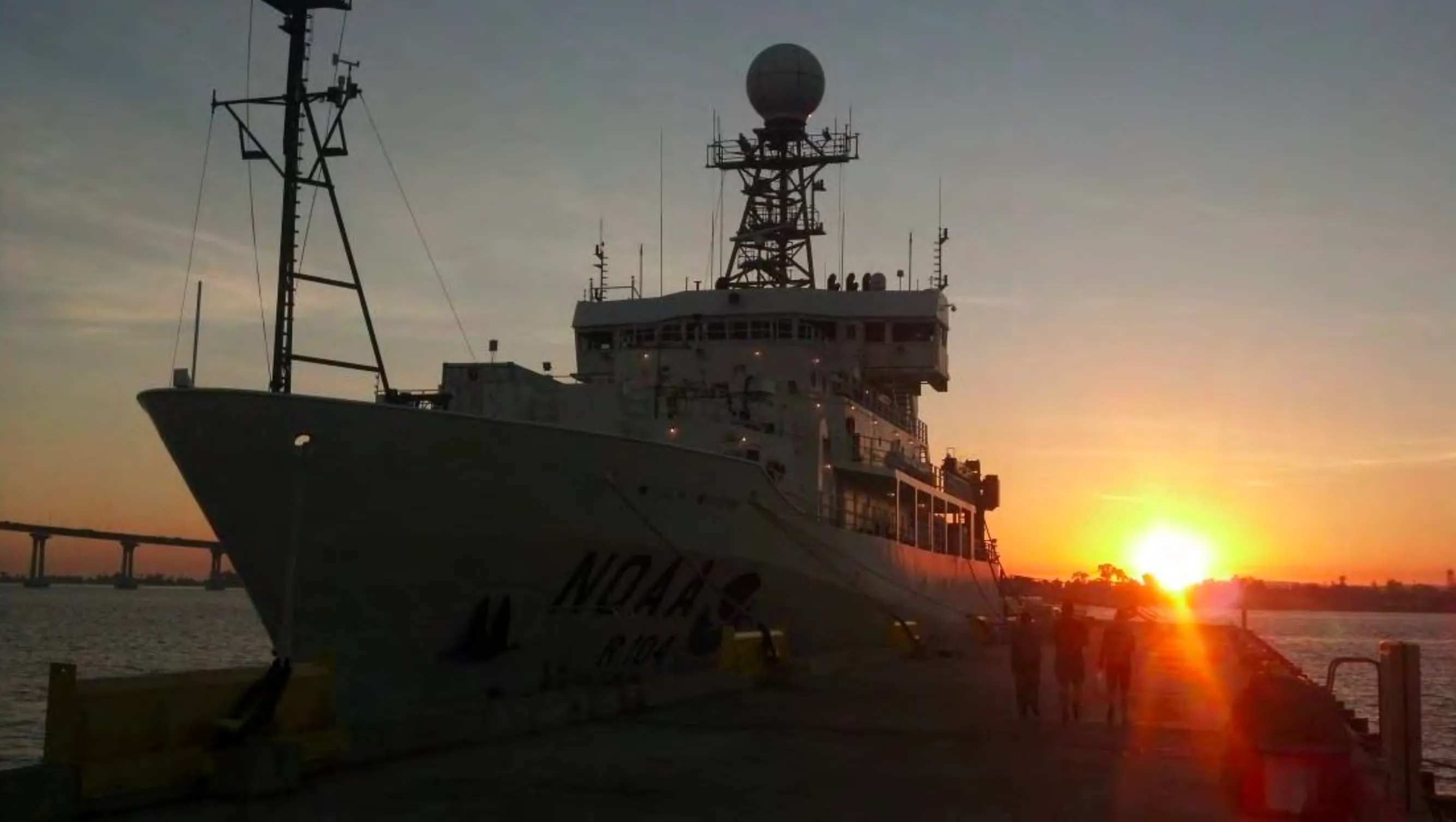
GO-SHIP P18 ran in two legs aboard the R/V Ronald H. Brown. Leg 1 went from San Diego, USA, to Hanga Roa, Rapa Nui (Easter Island), Chile, from November 19 to late December 2016. Leg 2 went from Hanga Roa to Punta Arenas, Chile, from December 30, 2016, to February 3, 2017. Together the legs occupied 211 stations on the P18 line, plus 2 SOCCOM float calibration stations, and deployed 29 floats and 20 drifters.
Brendan Carter (PMEL) and Annie Bourbonnais (WHOI) were chief and co-chief scientists for Leg 1. Rolf Sonnerup (JISAO) and Sarah Purkey (LDEO) led Leg 2.
The section runs along 110°W from offshore Cabo San Lucas to 5°S, angles southeast across the East Pacific Rise to 103°W at 10°S, and then follows 103°W toward Antarctica. It connects the oxygen-deficient waters of the Eastern Tropical North Pacific with the Southeast Pacific, where Antarctic Intermediate Water and Subantarctic Mode Water form. It was the third occupation of the line, after 1994 (WOCE) and 2007/08 (CLIVAR).
For Bio-GO-SHIP, the Martiny lab (UC Irvine) took 105 surface genetics samples, roughly one per degree of latitude, and 198 underway particulate organic matter samples. The samplers were Alyse Larkin (Leg 1), Catherine Garcia (Leg 2), and Chilean observer Javiera Veloso. On Leg 2 a new iTag project led by Bethany Kolody (UC San Diego) collected 302 microbial barcoding and transcriptomics samples at 25 stations along 103°W. It sampled up to 12 depths per station and targeted the chlorophyll maximum, oxygen minimum, deep water, and bottom water.
Operations
Problems with the ship’s Z-drives after dry dock delayed the start by 18 days. The Brown left San Diego on November 12, had to return two days later for more repairs, and finally departed on November 19. Three scientists couldn’t join Leg 1 after the delays, and others took on their work.
Because of the late start, the research permit for the Mexican EEZ expired the day the ship arrived. The team lost about 1.5 days waiting on the first station before an extension came through. The Chilean clearance didn’t cover the waters around Isla Salas y Gómez, so part of the line was moved up to 1.5° east, and Leg 1 ended early at Easter Island.
To make up time, the double-resolution sampling band around the equator was narrowed from ±5° to ±3°, and planned work on the P17 extension toward Chile was cancelled.
At station 18, the aft winch began spooling out uncontrollably while the CTD/rosette was being recovered. The winch operator stopped it with an emergency brake, and the package was saved. For the next several weeks the team used the forward winch, with a pneumatic rope “tugger” to guide the package onto its deck tracks. On Leg 2 the ship’s engineers traced the problem to a loose bracket in the brake assembly. The aft winch was back in use after a midnight re-termination.
Finding a reliable CTD took about a day of troubleshooting. The first unit failed after leaking under pressure, and two others had wiring faults or not enough power for the full sensor package.
Leg 2 left Easter Island two days late. The team kept the line clear of the Chilean EEZ by occupying stations along 101°30’W before returning to 103°W.
South of 60°S the ship worked among icebergs. The last 103°W station (#208) was at 69°36.5’S, almost surrounded by sea ice. The team then followed the ice edge east to a final P18 station at 70°00’S, 100°14’W on January 28. On the way to Punta Arenas they stopped for one more calibration station at a recently surfaced SOCCOM float.
Scientific highlights
Off Mexico, the team sampled the oxygen-deficient zone (ODZ) and deployed an APL/UW gas-tension float designed to monitor it. This region has been identified as one where the effects of climate change on interior ocean oxygen may already be detectable.
The shipboard ADCP recorded the strong, tangled current structure around the equator, where the Coriolis force vanishes. CTD data showed the sharp change from low-oxygen water in the north to well-oxygenated, fresh intrusions of Antarctic Intermediate Water and Subantarctic Mode Water further south.
Preliminary comparisons with the 2007/08 occupation showed dissolved inorganic carbon still increasing over the decade, especially near the surface, consistent with continued ocean uptake of human CO₂ emissions.
Fun facts
- The pre-departure update was titled “Weekly report -1” so that the numbered reports could start once the ship actually sailed.
- Station 116 was occupied during the ship’s New Year’s Eve party.
- On Leg 1, the team ran out of milk and got down to their last jelly beans. On Leg 2, the weekly “box score” always reported the ice cream as “still in good supply.”
- During one cast the primary CTD sensor started giving strange readings. When the package came back on deck, a 1.5-inch shrimp was found jammed in it.
- One night a burst water line flooded a stateroom and set off the fire alarm while the CTD was at 3,000 m.
- A scratched float was touched up with Sea-Bird enamel before deployment, since there was “no fingernail polish on this ship.”
- An “XCS” section, short for “eXpendable Chief Scientist,” was run by small boat on drill day.
- At the end of the line, Captain Kamphaus marked the Brown’s position on a Chilean Navy ice chart “as a therapeutic measure,” to show the chief scientist the ship really couldn’t go any further south.